
A major atmospheric river storm — strong enough to potentially rival some of the extreme storms that have walloped Southern California in recent winters — is barreling toward the coast, raising the specter of damaging landslides and flooding across the region.
This storm, forecast to reach Southern California sometime before Valentine’s Day, is expected to be the strongest of the winter so far, according to the National Weather Service office in Oxnard.
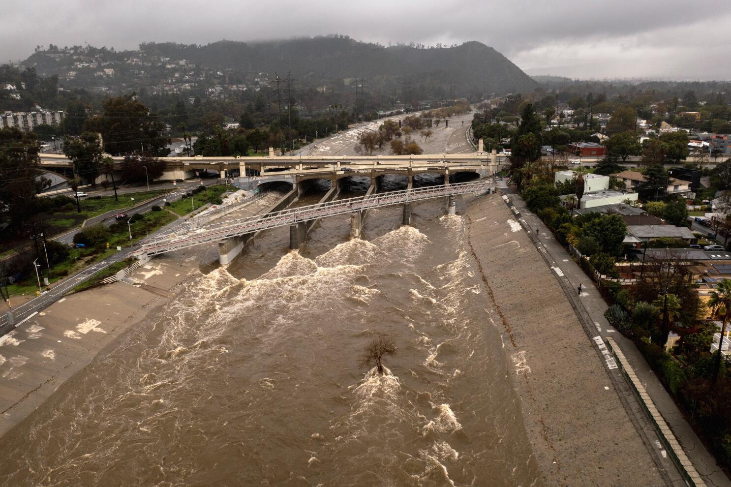
It threatens to drop large amounts of rain — 2 to 4 inches or more along the coast and in valleys, 4 to 8 inches or more in the mountains and foothills — across a swath of the Southland. There’s a 60% chance of rainfall of that magnitude in Santa Barbara and San Luis Obispo counties, and a 30% chance in Los Angeles and Ventura counties.
There’s also a chance rainfall could be extreme, along the lines of the powerful storm of Jan. 9, 2023, which forced the mass evacuation of Montecito and other communities, caused significant flooding, and resulted in the deaths of two motorists — including a 5-year-old boy — who were caught in floodwaters in San Luis Obispo County.
“Definitely, people should be prepared that this is going to be the wettest period that we’ve had so far this rain season — since the fires started,” said Ryan Kittell, a National Weather Service meteorologist in Oxnard.
“People should prepare for really the worst-case scenario,” Kittell said, where heavy rainfall could send mud and debris sliding off hillsides, mucking up roads and possibly colliding into homes and other structures. For Santa Barbara and San Luis Obispo counties, the storm could start as early as Tuesday night or as late as Thursday evening, Kittell said. The highest threat is expected to be between Wednesday night and Thursday night.
“Certainly, if you are in a vulnerable area around those burn scars, keep track of the weather each day and see how the projections trend and what seems to be the most likely outcome going forward,” Kittell said. “Prepare for the worst and hope for the best.”
Santa Barbara and San Luis Obispo counties could see 12 to 24 hours or more of rainfall, with precipitation coming down at rates between half an inch to an inch or more per hour. Rainfall rates of half an inch or more per hour are capable of causing significant debris flows, in which water can pick up mud, rocks, branches and sometimes massive boulders, traveling at speeds exceeding 35 mph.
A rainfall rate in that range “typically does lead to some flooding concerns, especially for the recent burn areas,” Kittell said. That includes the burn area of the 2024 Lake fire, which scorched 38,664 acres in the Santa Barbara County mountains north of Los Olivos.
As rainfall rates approach 1 inch per hour, flooding can be triggered anywhere, especially on roads and in small creeks, Kittell said.
In the extreme rainfall scenario — which has a 20% chance of happening in Santa Barbara and San Luis Obispo counties, forecasters estimate — there could be 4 to 8 inches of rain on the coast and in the valleys.
“Two to 4 [inches of rain] will definitely give us issues, but 4 to 8 would be pretty extreme,” Kittell said. “And looking back at some of the projections leading up to some of our recent pretty extreme events over the last few years, if this plays out, then we are looking at totals that would be very close to and approaching Jan. 9, 2023.”
The big difference, though, is that storm was one of a string of powerful systems that hammered California from late December 2022 through mid-January 2023. This season has been far drier — one of the driest starts to the rainy season in modern California history — “so the impacts will probably be less,” Kittell said.
For Los Angeles and Ventura counties, besides the 30% chance of large amounts of rain, there’s also a 50% chance of moderate amounts. The storm could arrive as early as Wednesday morning or as late as Thursday night. The time of highest threat is Thursday morning to Friday morning — Valentine’s Day - with a 5% to 10% chance of thunderstorms.
A moderate event could cause some road flooding, but the risk of debris flow would be low, though still present, Kittell said.
Large amounts of rainfall would result in a “fairly high risk” of producing downpours so intense that all of the region’s recent burn areas are at risk for debris flow, Kittell said.
Recently burned areas are at risk for landslides in heavy rain, as the soil is no longer anchored by healthy vegetation.
Heat from fire makes it harder for soil to absorb water, and ash also tends to clog the soil, so water is more likely to flow along the surface rather than percolating down.
The storm is also expected to be strong in the San Joaquin Valley and Sierra foothills, potentially affecting travel along the mountain passes of Kern County, the weather service office in Hanford said.
The storm is expected to be far weaker once it reaches San Diego and Orange counties and the Inland Empire, and have a relatively moderate effect in the Sacramento Valley.

The Sierra Nevada could see 2 or more feet of snow, and areas around the elevation of Lake Tahoe could see “their largest snow event so far this season,” according to the weather service office in Reno. Los Angeles, CA - February 05: A pedestrian crosses the street in the rain with an umbrella and a view of the Sixth Street Viaduct in Los Angeles Wednesday, Feb. 5, 2025. (Allen J. Schaben / Los Angeles Times)